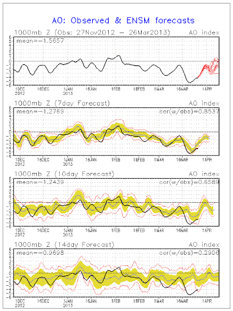
Good evening everyone! The massive -AO and blocking pattern that we have been seeing looks to weaken some as we head towards the end of March and into the start of April. You can see that occurring by the graph below.
Does this mean that we will see a big time warm up? The answer is simple. No. Why you may ask? As the block eases we are going to see a massive ridge of high pressure, or block over Alaska. This is known as a negative phase of the EPO. A -EPO can sometimes allow for cooler then avg. temps over the Eastern US. This feature looks to develop next week and continue for the next couple of weeks. While we may see a few warm days every now and again over the next couple of weeks, the threat for significant and long lasting warmth, will most likely not occur.
You can see the big ridge below on the 500 MB anomaly map from this afternoon's 12Z GFS Ensemble model run. This is valid for the 11-15 day period.
The 12Z ECMWF Ensembles also agree for the 6-10 day period. You can see the ridge over by Alaska.
The bottom line is, if you're looking for sustained above avg. temperatures, or some fun tracking a lot of severe weather in the Ohio Valley, chances are you won't be a happy camper until we get deep into April or once we get into May.
Lester Rhoads
Long Range Forecaster
Ohio Weather Blog


No comments:
Post a Comment