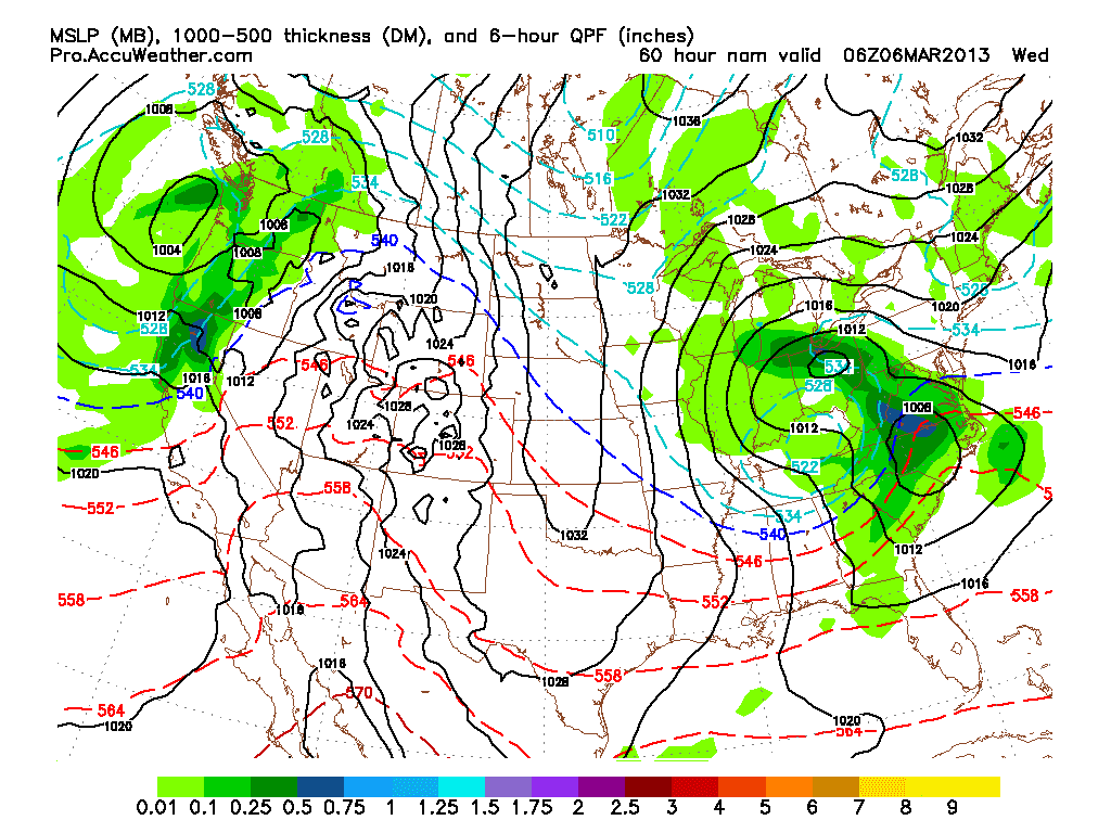
As you all now or have heard of the
storm that we might get Tuesday night and into Wednesday is looking
like the norther section of Ohio will get hit. Looking at the NAM
model it is showing at 60hrs that the low will be over north central
Ohio. This low will then die out and transfer its energy to the low
that is over the southeastern us. You can see the upper level low over southern ohio and this will also aid in the heavier snow fall in the northern counties.
Now the GFS at 60 hrs it has the
surface low just a bit south and east of where the NAM has it. The
American models are north while the ECMWF is a bit further south. I
don’t think the ECMWF is correct and this will need to be watched.

Bryan Polivka
Cleveland, OH
Ohio Weather Blog Forecaster
No comments:
Post a Comment